
Bhuwan Singh Bisht
Licensed Geomatics Engineer · Survey Officer, Government of Nepal · Instructor, LMTC · Vice President, NGES
Geomatics Engineer and Survey Officer with professional experience in surveying, cadastral mapping, GIS, remote sensing, GNSS, geodesy, UAV, LiDAR, and land administration. Currently serving as Instructor at LMTC, Government of Nepal, and pursuing an MSc in Geoinformatics at Nepal Open University.
About Me
Passion & Purpose
Passionate about applying geospatial science and surveying knowledge to real-world challenges in land management, infrastructure, environmental analysis, and spatial decision-making.
At LMTC
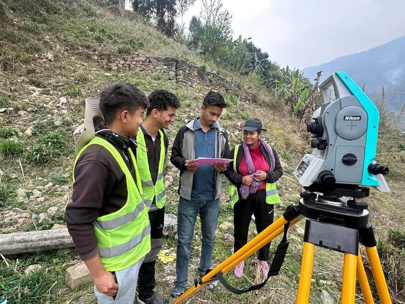
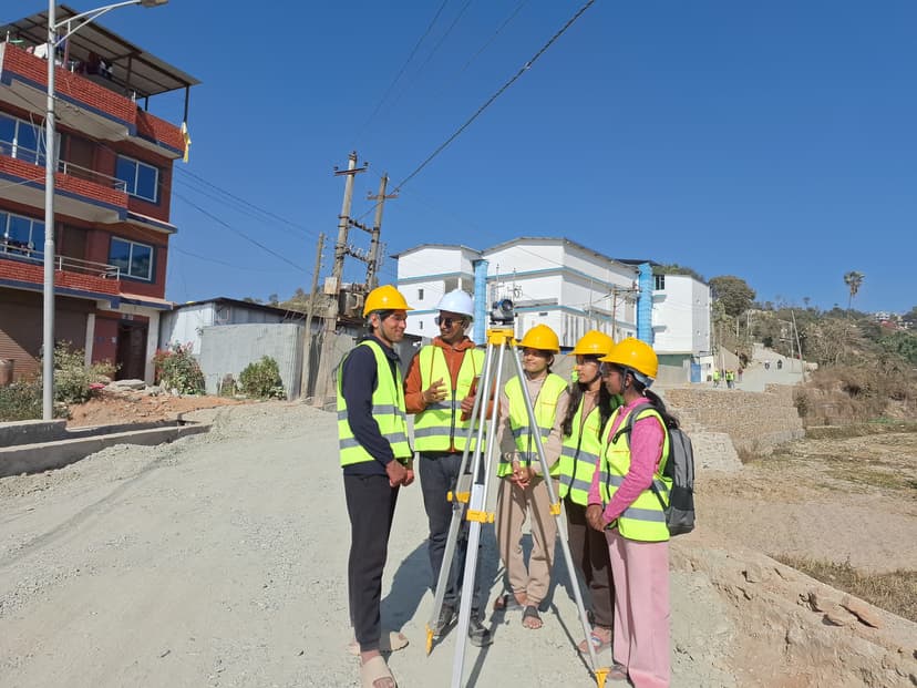
Designing and delivering training programs in surveying, mapping, GIS, remote sensing, UAV & photogrammetry, DGPS, geodesy, and land administration. Committed to knowledge sharing and professional development in geomatics.
Beyond the Map
Beyond the technical profession, I also write poems and reflective pieces from time to time. Writing gives me a creative space to express ideas, emotions, and observations beyond maps, data, and fieldwork.
Professional Journey
My professional journey combines government service, field surveying, technical instruction, applied research, and leadership in the geospatial community — deepening my commitment to advancing geomatics in Nepal.
Experience
I contribute to professional engagement and leadership in Nepal's geomatics community through strategic coordination, knowledge sharing, and technical networking. My role supports the promotion of geospatial education, innovation, and collaboration among professionals and emerging geomatics practitioners.
I design and deliver professional training programs in surveying, mapping, GIS, remote sensing, UAV and photogrammetry, GNSS and DGPS, geodesy, and land administration. My work includes field-based technical sessions, lectures on theoretical, technical, and legal aspects of land management, research supervision, and institutional planning.
Survey Officer
Ministry of Land Management, Cooperatives and Poverty Alleviation, Government of NepalI serve in the public-sector surveying and land management domain under the Government of Nepal, contributing to professional surveying practice, institutional development, and technical service in land-related fields.
I conducted field surveys and prepared legal reports, cadastral maps, and boundary descriptions to support court decisions on land-related cases. I worked closely with lawyers, judges, and other professionals to clarify technical aspects of land measurement, land disputes, and property division.
GIS Analyst
Monarch Survey & Engineering Consultant Pvt. Ltd., Nepal
I provided GIS-based technical support and analytical reporting for engineering projects. My work involved managing and interpreting geospatial data for urban planning, infrastructure development, and engineering design support.
Selected Projects
Kathmandu Land Use Analysis
Evaluating Land Use Changes in Kathmandu District from 2017 to 2024

GIS Based Land Valuation
Utilizing Geographic Information Systems and spatial analysis techniques to assess property values based on location, accessibility and land use patterns
Nepal Geospatial Infrastructure Analysis
Current Status and Future Challenges of Geographic Information Infrastructure in Nepal

DTM Comparative Evaluation
Comparative evaluation of Digital Terrain Models derived from UAV, Airborne LiDAR, and SRTM — validated against total station ground survey for accuracy assessment.

Flood & Landslide Damage Assessment
UAV survey, orthophoto generation and cadastral map superimposition to assess flood and landslide impacts in the Roshi River corridor and Panauti landslide-affected areas.

Land Fragmentation Trends in Koteshwor
Four-decade spatial analysis examining land fragmentation trends and parcel-level transformation patterns in a rapidly urbanising locality.
Publications
Multi-Temporal Land Cover Analysis of Kathmandu Using GEE and ENVI: A Comparative Study of SVM and RF Algorithms
Analyses land cover changes in Kathmandu District and compares SVM and RF classification techniques using both Google Earth Engine and ENVI. Highlights rapid urban growth, decline in agricultural areas, and the effectiveness of cloud-based remote sensing tools.
Climatic Drivers of the 2024 Thyanbo Glacial Lake Outburst in Nepal Deciphered Using Sentinel-2 NDWI/MNDWI Analysis
Investigates climatic and hydrological conditions preceding the August 2024 Thyanbo GLOF using multi-temporal Sentinel-2 imagery and climate data. Elevated temperatures combined with intensified monsoon precipitation triggered rapid lake expansion and moraine dam failure.
Effect of Urban Growth on Land Surface Temperature and Mitigation Strategies
Uses multi-temporal Landsat data for supervised classification, change detection and LST analysis in Kathmandu Valley. Shows a 13% increase in urban area (2013–2019) with higher LSTs concentrated in built-up surfaces. Advocates urban forestry and reflective materials.
GNSS-Based Crustal Deformation and Strain Accumulation in the Nepal Himalaya
Reveals significant northward (15–20 mm/yr) and eastward crustal movement driven by Indian–Eurasian Plate convergence, with strong strain accumulation along the Main Himalayan Thrust. Includes a web-based platform for interactive visualization of deformation and seismicity.
Technical Skills
Geospatial & Surveying
Software & Platforms
Programming & Web
Professional Strengths
Events & Professional Engagement
Actively participating in conferences, workshops, and technical trainings in surveying, GIS, remote sensing, UAV, LiDAR, and geospatial capacity building — as coordinator, facilitator, volunteer, and technical resource person.
Conferences & Workshops
Attended
- 5th Young Surveyors Network Asia and the Pacific Meeting, 2024
- Workshop on Effective Land Administration in Nepal, 2024
- Training of Trainers for Land Literacy Program, 2024
- International Workshop on Land Use Planning and Land Administration, 2023
- Training of Trainers programs, 2022–2024
- ISO 9001:2015 Quality Management System Workshop, 2022
- Pre-Service Training for Newly Appointed Survey Officers, 2022
- LiDAR Data Application and Processing Training, 2025
- Basic Unmanned Aircraft Operations, 2025
- Total Station Calibration Training, 2024
Trainings & Events
Conducted
- Coordinator / Assistant Coordinator for geospatial and land management trainings, 2022–present
- Coordinator for Basic GIS and Instrument Handling for Local Level Employees, 2024
- Assistant Coordinator for Professional Course on Geomatics and Land Administration, 2022
- Assistant Coordinator for Surveying Instrument Calibration Training, 2024
- Coordinator for Land Literacy Program, 2022, 2023, 2024
- Coordinator / Assistant Coordinator for Advanced GIS, UAV, LiDAR, DGPS, Remote Sensing and Field Surveying trainings
- Conducted 10-day online QGIS training, 2023
Volunteering & Outreach
Community Contribution
Supporting event organization, technical demonstrations, training delivery, media preparation, and institutional outreach through national and international geospatial programs — including volunteer contributions in professional workshops and conferences.
Writing & Creative Works
Alongside geomatics and geospatial education, I occasionally write poems and reflective pieces — expressing thoughts, emotions, and experiences through nature, memory, society, and place.
Coming Soon
Poems and reflective pieces will be published here. Check back soon.
Education
MSc in Geoinformatics
Nepal Open University, Manbhawan Lalitpur, Nepal
Advanced study in geoinformatics with focus on spatial analysis, GIS, remote sensing, machine learning, web mapping, and earth observation. Thesis work focuses on urban heat island analysis and prediction.
Bachelor of Geomatics Engineering
Himalayan College of Geomatics Engineering and Land Resources Management
+2 Science
Triton International College
Certifications, Memberships & Recognition
Get In Touch
Open to academic collaboration, professional networking, research discussions, technical training opportunities, and geospatial projects.